Detailed Trip Part Map 40°14'N, 23°14'E - 40°17'N, 23°35'E
Sun Aug 19, 2001. From 1.76 km E of Floyita (populated place) (topological, street map) (18:48:30) to 0.88 km NE of Sargani Point (cape) (topological, street map) (19:13:39) covering a travel distance of 35.39 km at an average speed of 84 km/h over an area of 150 sq km. Duration 25 minute(s), travel time 25 minute(s).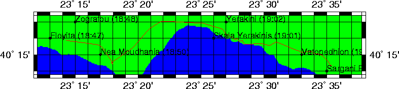
Trip index Previous Next